
Coastal flooding
JM Coastal can develop coastal flood models that combine a range of physical processes to investigate flood reduction measures, develop real-time warning systems or for catastrophe risk analysis.
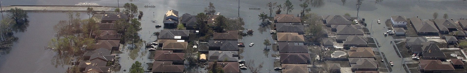
Low lying coastal and estuarine regions can be susceptible to coastal flooding. This can have devastating consequences as these regions can often be densely populated and have high concentractions of infrastructure. Coastal flooding is caused by meteologically driven events that cause high tidal levels and waves to flow inland beyond the expected high tidal extents over natural topography and coastal defences. This can cause damage to buildings, roads and farmland as well as presenting a danger to life.
From a modelling perspective, coastal flooding is a complex task and is often the result of a combination of physical phenomena that need to be simulated accurately to capture the true extent of the inland inundation. These include:
- Tide and storm surge modelling
- Wave modelling including wave overtopping and wave set-up
- High river and estuarine flows
- Defence breaching
- Inland propagation of the flood wave
Models from the Telemac or DHI suite of 2D hydrodyamical flow and spectral wave models can be used to simulated the offshore wind-driven surge and wave generation right up to the defence overtopping and breaching and the inland propgation of water. In other instances, it may be more efficient to use these models up to the coast or defence line and then model the inland flow of water on high resolution grids using models such as TUFLOW or Flood Modeller Pro, possibly taking advantage of high resolution lidar data and the speed offered by GPU implementation. You can read more about simulating coastal flooding due to the combination of extreme waves and water levels here.
December 2013 storm surge event
The 5th of December storm surge event caused the highest water levels along the UK east coast since the devastating storm surge of 1953. Fortunately, this time advanced warning and improved coastal defences reduced the damage and loss of life that was experienced 60 years ago. However, storm surge levels reached record levels at the Hull Barrier (5.8m AOD) which prevented the surge propagating up the River Hull and causing significant flooding. However, significant flooding still occured in Hull along the banks of the Humber particularly in the Albert Dock region where the lowest defence height is 5.04m AOD. Visualisations from a modelling study of the event show the storm surge propagating up the Humber Estuary before overtopping the defences in the Albert Dock area and inundating part of the city of Hull.
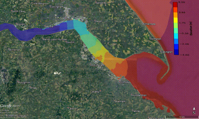
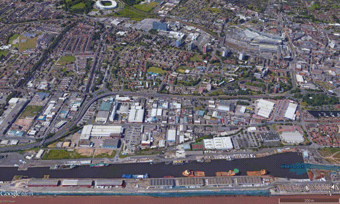
The surge levels overtopped the Albert Dock defences and entered through the lock gate before filling the dock and flowing inland flooding homes, roads and businesses including Kingston Retail Park. The high surge levels also caused flooding at other locations along the east coast including the town of Boston and a nearby industrial estate and recycling centre due to a breaching event (see modelling study here).
For more information on the development and use of coastal flood models please get in contact: john.maskell@jmcoastal.co.uk